


Hike these trails in the William C. Whitney wilderness
Interesting history belies much of the breathtaking beauty in the wild spaces of the Adirondack Mountains, and the William C. Whitney Wilderness Area is no different. Relatively recent state land acquisitions make up the area, which has a history of Adirondack Great Camps, private parks, a railroad, and extensive logging. While this might seem like the opposite of wilderness, this area, with its historical logging roads used as access corridors for hiking, can be seen as lands returning back to their original wilderness states. The main form of recreation here is paddling, but enjoying the ponds and various views can be done sans canoe.
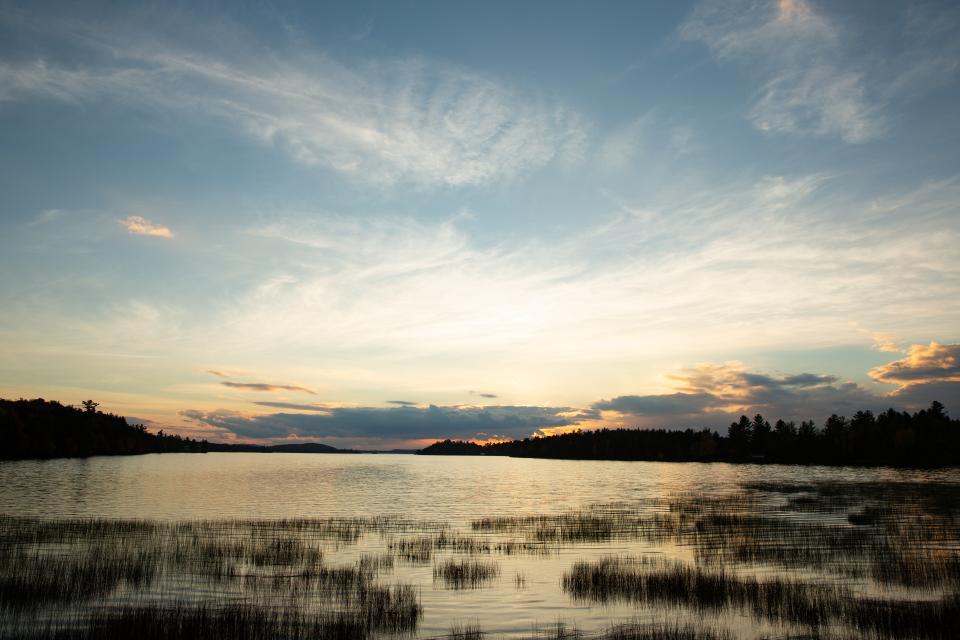
Lake Lila
A short walk that can be added to many of the nearby destinations, Lake Lila boasts being the largest Adirondack lake entirely within the Forest Preserve. Hike in via the 0.3-mile canoe carry to the sandy beach, close to where designated campsite #1 is located. A view from here can be a good sign of things you’ll see if you decide to do the next hike.
Mount Frederica
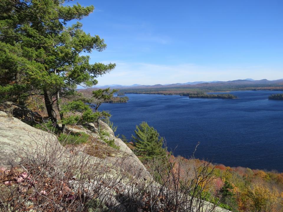
From the same parking area as Lake Lila, a trail within the Whitney C. Wilderness leads to the summit of Mount Frederica, which is actually in the Five Ponds Wilderness. You’ll use Lake Lila Road to access where you turn off for the mountain. Most of the hike is either on old road or remnants logging paths, but transitions to a more classic trail close to the top. Along Lake Lila Road, several sandy beaches look out over the lake, which in the fall is a crisply contrasting mix of evergreens and deciduous trees changing colors. You’ll even pass by, and be able to spot, the cliffs of Mount Frederica that fall towards the waters edge. From the top, the peninsulas, coves, and a couple islands on the lake, along with an expanse that includes everything from the High Peaks to the lowlands of the western and southern Adirondacks, can be seen.
Bum Pond and Camp Bliss
There are a few backcountry ponds accessed from the Lilypad Pond trail, with the eastern shore of Bum Pond being the closest of them. You start a day of hiking from the Burn Road parking area, and traverse the easy grades of the Lilypad Pond trail, skirting the northern shore of Little Tupper Lake. After just under 4 miles, a sturdy bridge spans Charley Pond Stream, a superb spot for a snack. After about another mile, you reach your first main junction, where you’ll turn left for Bum Pond and Camp Bliss. The grassy-edged Bum Pond breaks up the hike, providing a good rest stop before you continue to Camp Bliss. The site of a private home at an inholding of land, later a hunting camp, and now a reclaimed area with no buildings, is a beautiful spot at the southwestern reaches of Little Tupper Lake. Head back the way you came, or consider backpacking to some of the other ponds further along the Lilypad Pond Trail.
Bonus hike: Buck Mountain
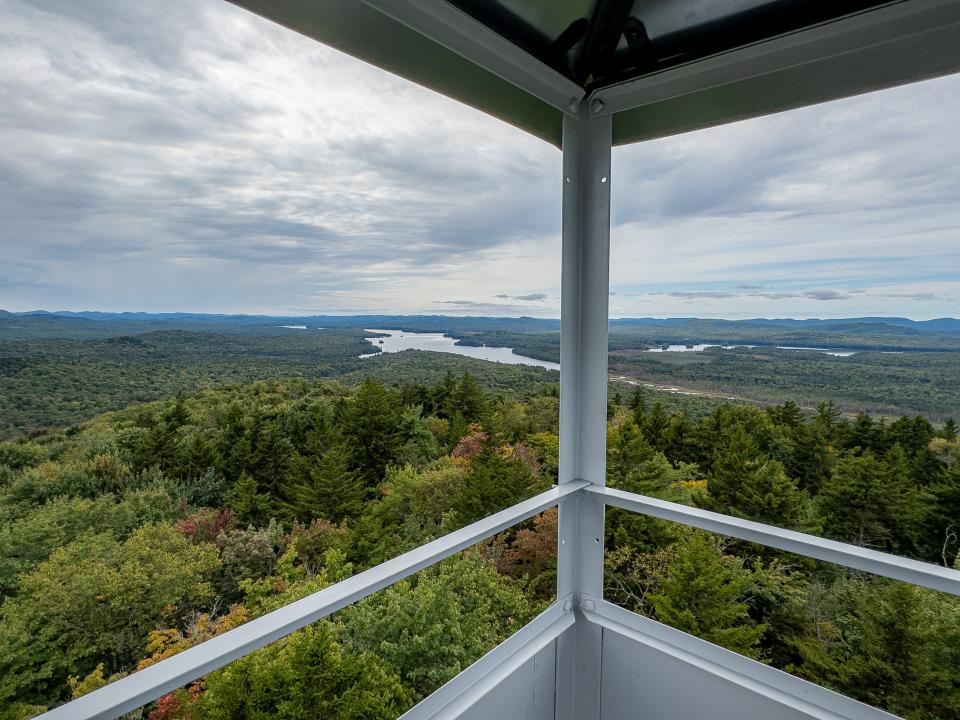
While not in the William C. Whitney Wilderness Area, this nearby mountain boasts a new trail to a firetower, with unparalleled views of Little Tupper Lake and the WCW wilderness. Head up there after some of the hikes above, and see if you can trace out where you walked!
Being so close to Long Lake, pick up a lunch at ADK Trading Post before you go explore! Post-hike, head back into town for some food and drinks at any of the amazing dining options.


