


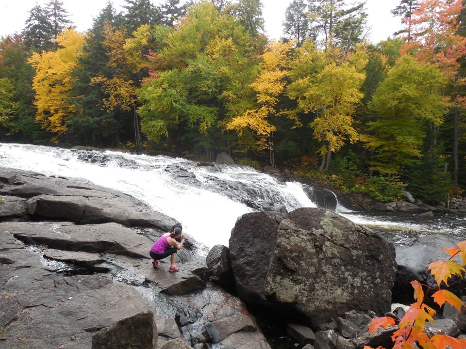
Spring hiking in the Adirondacks is unlike being there any other time — the place feels like it's overflowing. Water spills off of cliffs that are dry most of the year and streams swell to magnificent proportions, sending impressively powerful flows over boulders and through narrow chasms. In the center of the region there's a waterfall challenge that provides a nice checklist and the promise of a patch for anyone who hikes to enough of the falls. It's a great place to start any time of year, but the list is pretty long. Try some of the hikes below for a solid introduction to the region's aqueous wonders, then start checking off those boxes after you've whet your appetite.
BUTTERMILK FALLS
If you want to start your waterfall journey nice and easy, there's no better destination than Buttermilk Falls. From the parking area the cascading rapids are visible through the trees, making it a short, easy walk to the base of the falls. If you visit in summer go for a swim at the base of the falls, then pull up a picnic table and enjoy lunch or dinner with a view.
Directions: From the intersection of Route 28 and Route 30 in Long Lake, follow Route 28/30 toward Blue Mountain Lake. Continue to North Point Road on the right, which is located on a sharp corner. Follow North Point Road for about 2 miles to the parking on the right.
DEATH Brook FALLS, A.K.A. Secret Falls
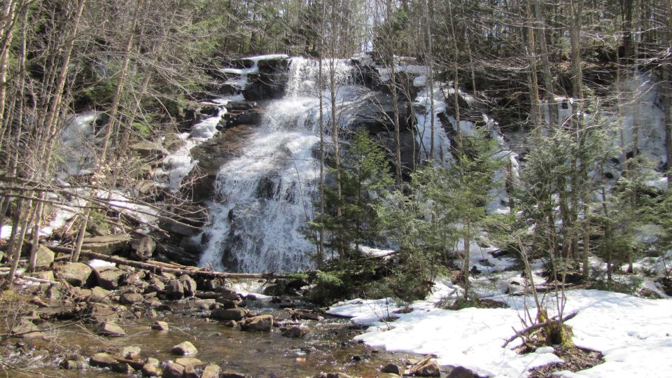
Two names, one waterfall. A roadside sign marks the start of this short, 0.2-mile long trail. Walk past a metal gate and head down to a large, open field that's also part wetland. Continue past this pretty spot, re-enter the woods and the falls will soon come into view. There are two options here — left goes to the base of the falls and right leads to the top. This is a fairly large waterfall, so exercise caution if approaching the top.
Directions: The trailhead is 3.2 miles east of the village of Raquette Lake, on the south side of Route 28. Look for a yellow gate 10 miles west of the village of Blue Mountain Lake or 3.6 miles east of Sagamore Road in Raquette Lake. Parking is sparse here, but for a day use fee you can park at the nearby Golden Beach State Campground.
LIMEKILN FALLS
Limekiln Falls is really a series of waterfalls or rapids, about a half mile of them, so set aside some time to explore the entire stretch. The trail is a little over 2 miles long, but it's pretty easy and the scenery is varied so it goes by fast. The path passes through a large field and crosses a series of bridges before following the outlet to the beautiful Limekiln Lake. After crossing the brook a few times, the beginning of the waterfalls is reached. Note that there is a day use fee to enter Limekiln State Campground, where the trail begins.
Directions: Head south on Route 28 in Inlet for 0.8 mile and make a right at the golf course to head south on Limekiln Road. Drive for another 1.8 miles to the Limekiln Lake DEC Campground entrance.
Auger Falls
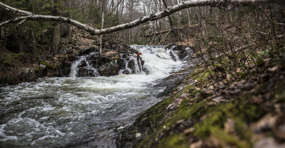
There are two trailheads from which to approach Auger Falls, so two cars can be used to make this an 8 mile through hike. Either way this wide trail, which is a snowmobile route in winter, follows gently rolling terrain as it approaches the falls. Be sure to ignore the numerous side trails and stay on the well-marked main route. The falls appear around the halfway point. They roar through a deep gorge that's fun to explore, just be wary of the slippery rocks.
Directions:
Western parking: From the intersection of Route 8 and Route 30 in Speculator, follow the convergence of Route8/30 toward Wells. Continue for about 6.5 miles to Old Route 8 on the left. Park at the bridge.
Eastern parking: From the intersection of Route 8 and Route 30 in Speculator, follow the convergence of Route8/30 toward Wells. Continue for about 8.25 miles to the trailhead on the left.
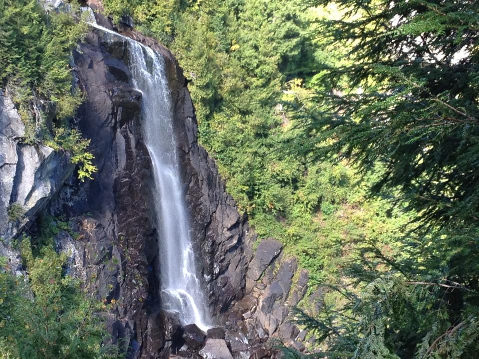
OK Slip Falls
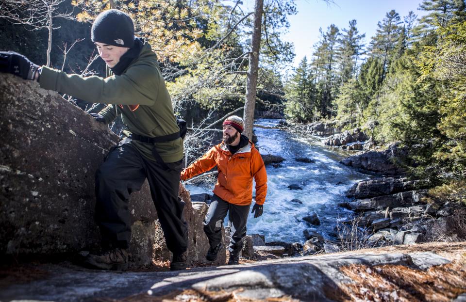
It's cliche to say "we saved the best for last," but it's also true. At 250 feet, OK Slip Falls is one of the highest in the Adirondacks, and since the route to the falls opened in the summer of 2014, it's also one of the newest trails in the region. The beginning of the 3-mile long trail shares the route to Ross, Whortleberry, and Big Bad Luck Ponds. After a half mile, the trail to OK Slip Falls branches right. It then follows the remnants of an old dirt road before a right hand turn marks the final short push to the base of the falls. Be on the lookout for natural beauty along this path — birds and wildflowers abound, and it's not uncommon to see moose tracks along the dirt road.
As its height implies, OK Slip Falls is always magnificent. One of the prettiest times to see it is in the morning, just after the rising sun passes the top of a nearby hill, bathing the falls in warm light. By afternoon the deep gorge is fully shaded, but it's still a sight to behold.
Directions: The parking area for OK Slip Falls is in the Hudson Gorge Wilderness Area, which is on Route 28 7.5 miles east of the intersection of Routes 30 and 28 in Indian Lake. There is a wooden sign for the Hudson Gorge Wilderness Area at the parking lot. The trailhead is located on the north side of Route 28, 0.2 mile west of the parking area. Hikers will need to walk along the highway for 0.2 mile and cross the road to reach the trailhead. The wooden trail sign lists that this is the access to Ross, Whortleberry, and Big Bad Luck Ponds, in addition to OK Slip Falls.


