


Is it just me or is fall really the perfect time to go hiking? The bugs have left for the season, and taken the humidity with them. The scenery is stunning. And, best of all, there are so many places to explore that it’s not hard to find a new adventure.
The Adirondacks are incredible because there is so much public land open for hiking, canoeing, birding, skiing - all sorts of recreation! In fact, around half of the 6-million acres that make up the Adirondacks are open to the public. That means the other half is private, but at one location in Long Lake, there’s a special conservation easement which allows for public recreation on a privately owned parcel of land. The Cedarlands Conservation Easement is often quiet and overlooked, but it holds a few gems if you’re willing to step outside the “popular” trails.
The open-to-the-public portion of the easement lands at Cedarlands (almost 5,000 acres total) is divided in two areas: there’s Mud Pond, which is open for public use year-round, and the 3,000-acre McRorie Lake Area, which is open for public use from August 24 to June 23. (During the summer, the Leatherstocking Council of the Boy Scouts of America retains sole rights to use.)
So, it happened that I found myself in need of a new adventure one October morning and I decided to see what I could find at Cedarlands.
Getting there
Mud Pond Mountain was my destination. I had been eyeballing it on the map for awhile, and the recent shift into peak foliage season was inspirational enough to get me out the door.

Cedarlands is at the end of Kickerville Road in Long Lake, just outside of town. (Click the photo above to link to Google Maps for directions.) Don’t be totally fooled by the posted signs and private roads; at a large stone building, where the road looks like it should be closed to everyone but homeowners, keep driving straight. This is completely fine to access the conservation easement, and there are plenty of signs with directions. Please do remember, though, that this is technically private property so follow all rules and regulations, and park only in the designated area. Drive until you reach a gravel lot at the top of a hill on your left. From here, it’s all about the hike. The map above is GPS tracks of my route.
Finding solitude
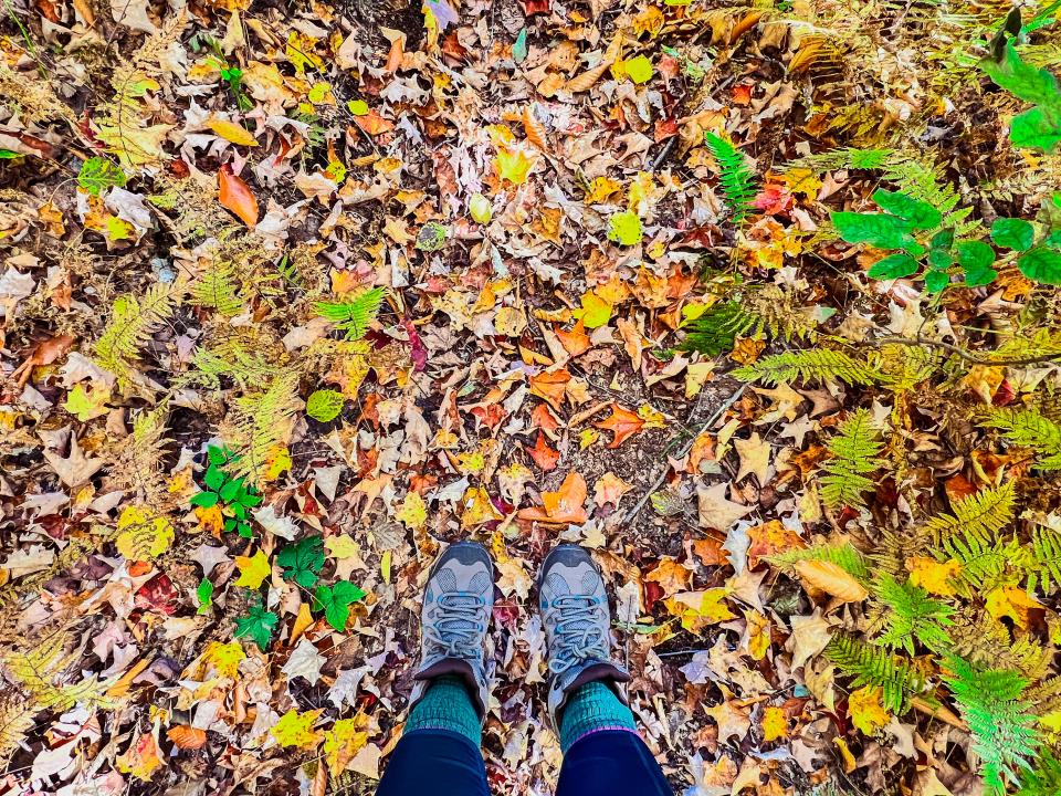
Especially in fall, when leaves draw big crowds, it’s sometimes hard to find peace in the woods. However, on this hike, quietness is abundant! I only heard the songs of birds, and saw a few toads and one snake. (I did also find some moose tracks!) It might not seem like it at first, hiking down a road, but this hike to Mud Pond Mountain is about as peaceful and “Adirondack” as it comes.

From the parking lot, start by walking on a dirt road. It’s just shy of 3 miles to the summit. It’s kind of a maze of roads, but follow the signs and arrows. After walking around a gate, enter a clearing and start the section of trail known as “Fish Camp Trail.” Soon, you’ll see Mud Pond through the trees and in less than a mile from the parking lot, you’ll find a canoe launch on the shore of Mud Pond. There’s a small path leading to the water; I highly recommend a stop on the way in or out; it’s a great spot to relax for a minute. And if you find yourself in need of a new fishing hole next summer, keep Mud Pond in mind!

After the canoe launch, the trail to the mountain continues down the old dirt road. Along the way, cross the bridge over the outlet of McRorie Lake and shortly after that, the canoe carry to McRorie Lake itself will be on the right. (I didn’t venture down this side trail, but I hear it’s short and well worth it.)

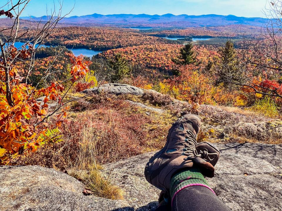
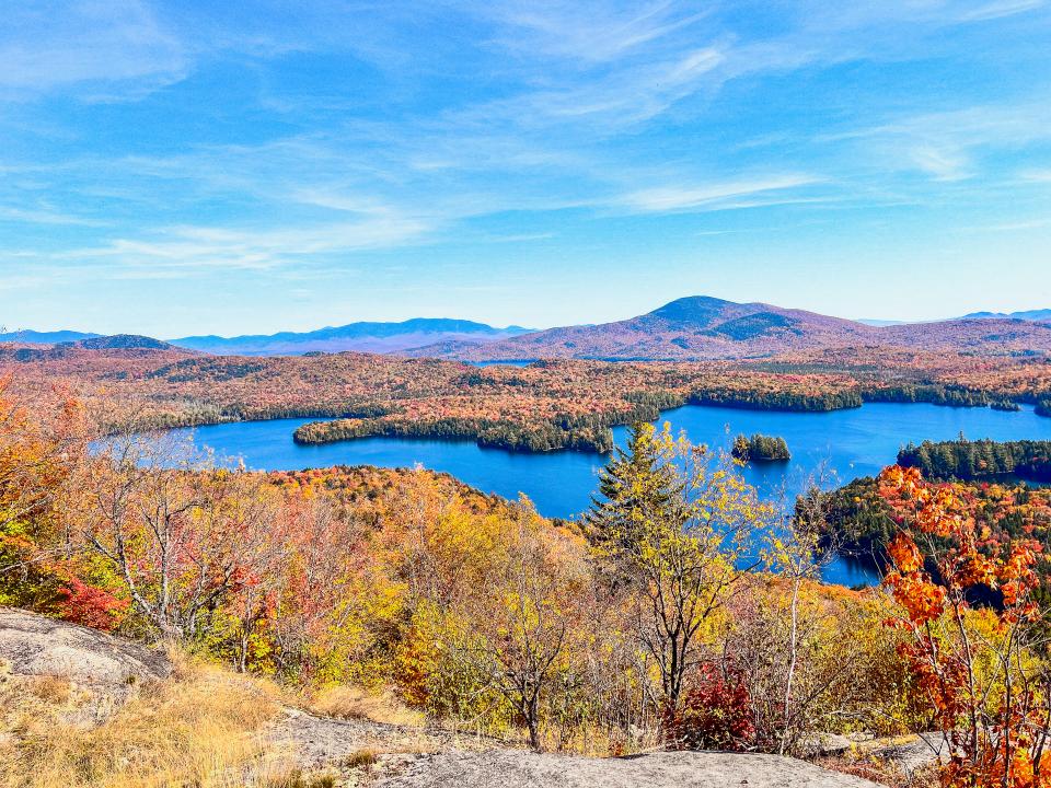
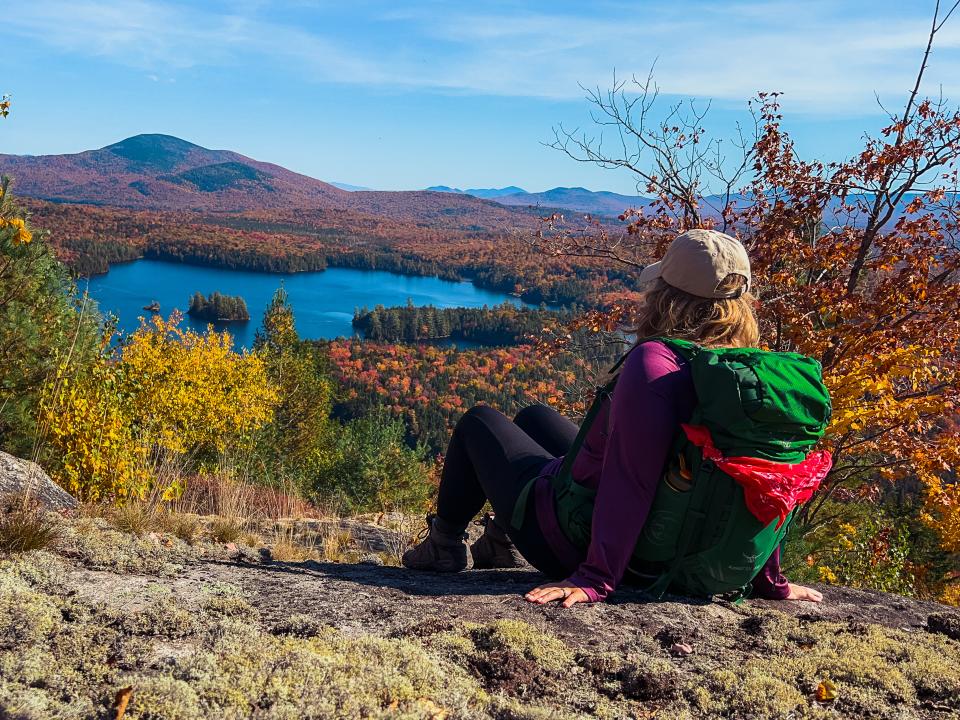
Around 2.25 miles from the parking lot, take a left into the woods to begin the 0.75 mile ascent to the summit. From here, the path becomes more of a typical Adirondack trail instead of following an overgrown road. For better or worse, the smooth sailing from the beginning 2 miles is over; it’s a steep climb to the summit - a real calf-burner! Just below the summit is a bedrock clearing. Unfortunately, this area has very limited views, but there’s a small taste of what’s to come. The good news is that you’re less than 0.25 miles from the summit! Nearer the summit, arrows point the way around sharp curves in the trail before the path eventually leaves the woods and emerges onto a glorious rock. The sweeping views of McRorie Lake, Mud Pond, the High Peaks, Kempshall Mountain (a former fire tower peak), and untouched wildernesses are breathtaking to say the least. (And if you’re like me, still trying to catch your breath from the steep climb, it’s even more breathtaking!)
After resting for a good half hour, enjoying the warm fall sun and peaceful quietness, I decided it was time to head home. When I arrived at the parking lot earlier, two fishermen were unloading canoes and heading to Mud Pond. When I returned to my car, they were gone, and it occurred to me that for awhile I was probably the only person in the 4,890-acre Cedarlands Conservation Easement. Now that is some serious fall solitude!
Don’t sweat the fall stuff
Everyone needs a little help sometimes! Here are a few safety tips for hiking in the fall:
- Fallen leaves can create some difficulty finding/staying on trails. Watch for markers to help locate the trail on the way to Mud Pond Mountain! The old roads are easy enough to follow, but the trail up the mountain is more challenging. However, blue markers are plentiful and will guide the way.
- Speaking of staying on the trail, keeping to the designated paths is the best way to avoid hunters. Know when fall hunting seasons run and wear bright colors when in the woods. Hunting is permitted here. Being aware of your surroundings is the best way to stay safe. Check the trail register to see who else might be around.
- Fall is unpredictable: it could feel like winter in the morning and spring in the afternoon! Be prepared with different layers and gear.
- The days are getting shorter. Don’t forget to pack headlamp(s) and extra batteries. You might not be planning on staying out after dark, but things happen sometimes. It’s better to be over-prepared than under.
And, as always, leave areas better than you found them. When you practice Leave No Trace ethics, you're helping create an Adirondack future that everyone can enjoy for years to come.
See you on the trails
This is not a trick. Treat yourself to this amazing fall hike! Remember, 3,000-acres of the Cedarlands Conservation Easement is only open to the public from August 24 to June 23. But even though there are times when the lands are closed off, there’s still plenty of time to explore. You better be-leaf that there's a lot to do this fall in Hamilton County - between events, delicious dining, and tons of trails to hike, you might want to spend a few days here to experience all fall has to offer.


