


The Adirondacks are filled with firetowers dotting the landscape, and Hamilton County just so happens to have a high concentration of them. Over the years, I’ve gotten to know and love these tower-topped peaks for typically being easier, half-day adventures. I also regularly recreate in the northern portion in the park, and rarely make the long drive to the southern portion. However, there are certain adventures that just seem to call to you when you’re looking at a map, making new goals, or just want to get away from the crowds on a weekend in the wilderness. Pillsbury Mountain is one of those adventures.
Hikers that have worked their way up Pillsbury in the summer months know that it’s a shorter hike, roughly 6 miles from the new, lower parking lot, and half of that is walking along an old road. Come winter, it’s a much different story. Roads close, snow falls, and the hiker traffic drastically decreases. What does this mean for the prospects of a Pillsbury pilgrimage during stick season? Well, I’ve got the answers for you!
A pit stop before the adventure begins
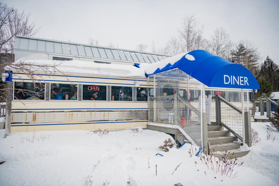
Before a big day, gear and willpower aren’t the only ingredients for success. Fueling your body for a long day is super important, and what better way to do this than taking advantage of a local eatery! Only about a half hour from the start of my day, and right on my drive to the Mason Lake parking area, was Chef Darrell’s in Blue Mountain Lake. I had heard rave reviews about this place, and the generous serving of banana-topped pancakes would prove crucial for my day.
Route breakdown
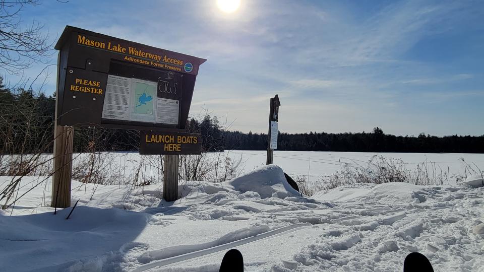
Since the approach road is closed in the winter, the trip is 16.2 miles round-trip, with 2,500 feet of elevation gain. 13 of those miles are ski-able, all the way up to the old trailhead 1.5 miles from the summit. Parking is at Mason Lake, off of NY 30, at a roadside parking area within sight of the lake.
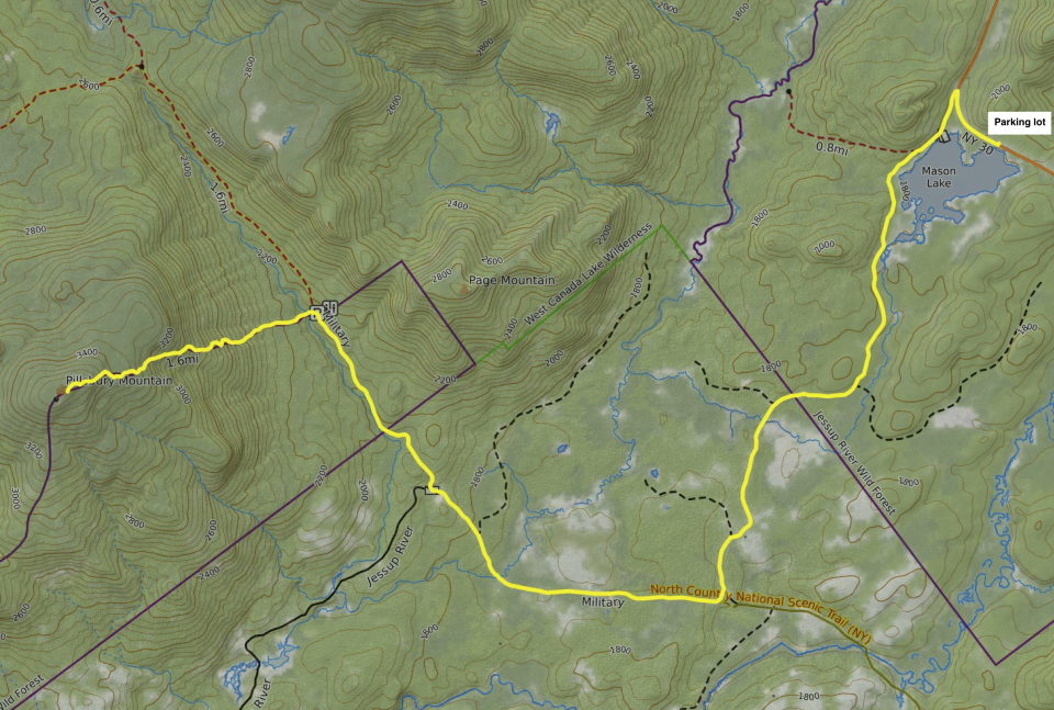
Skiing into the old trailhead
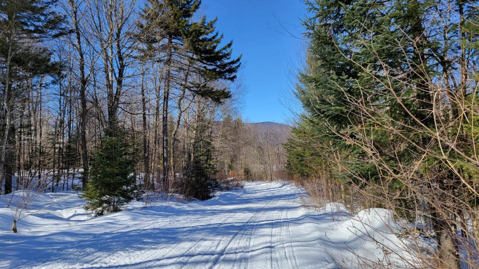
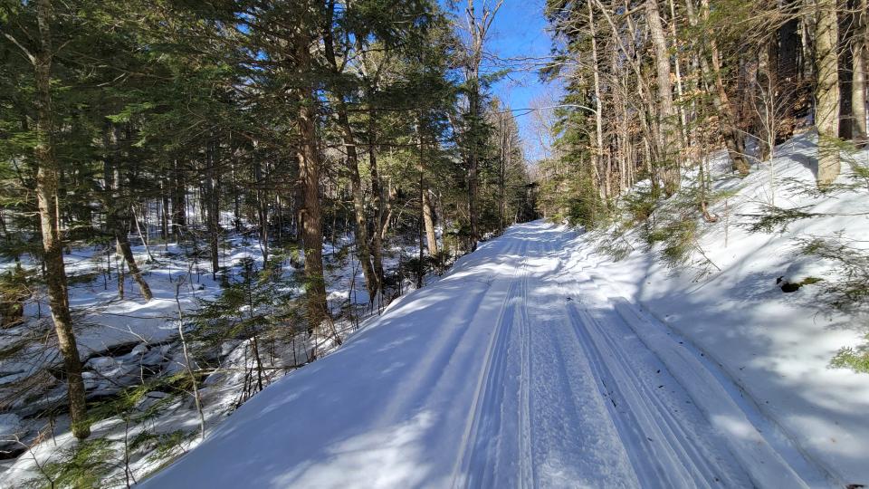
If I’m being honest, I wasn’t expecting much for hills or fun skiing terrain until the last stretch of my trip. I couldn’t have been more wrong. The skiing started right away, heading out from the Mason Lake parking area on the snowmobile trail that parallels the south side of the road. It gently curves around, then bears sharply south as you descend slightly to a small picnic area with a view of the lake. From here, an enjoyable and engaging series of hills began. I couldn’t believe how much fun I was having! The corridor is used by snowmobiles, and the path was practically a groomed ski-trail. There aren’t many tight turns, and when the turns do appear, the road is wide and forgiving.
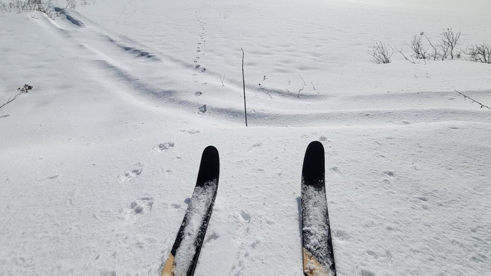
At 1.5 miles, I glided to a view of a wide-open wetland. Greeted by a chipmunk frantically foraging for food, I took in the view of towering pines on a backdrop of some of the bluest skies I had seen all winter. I hit another wetland at 2.8 miles, and was pleasantly surprised to see something I don’t lay eyes on often, bobcat tracks! Their rear paws land in the tracks made by their front paws, and you can’t typically see any claw marks since they are retracted most of the time. After a few minutes of soaking up the sun and keeping my eyes peeled for my furry friend, I continued on.
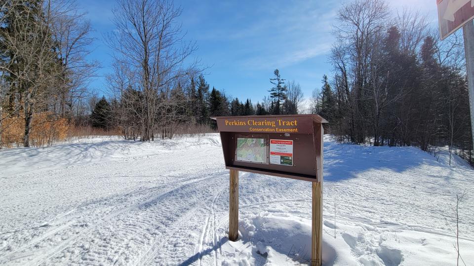
Not long after my last stop, I hit a major junction in the Perkins Clearing Tract at 3.6 miles. While there was a sign that promised the prospect of food if I continued straight, my goal was to the right. After gathering my bearings, shamelessly indulging in my map obsession by poring over the little one at the kiosk, and conversing with a couple of kind snowmobilers, I took off towards Pillsbury.
Within a few minutes I reached what would be my first glimpse of Pillsbury’s ridgeline at 4.3 miles, rising up at the height of land between it and Blue Ridge Mountain’s conglomeration of sub-peaks. Right after this I even spotted the fire tower glimmering in the sun, as if to signal its presence, and welcome me to this slice of the park.
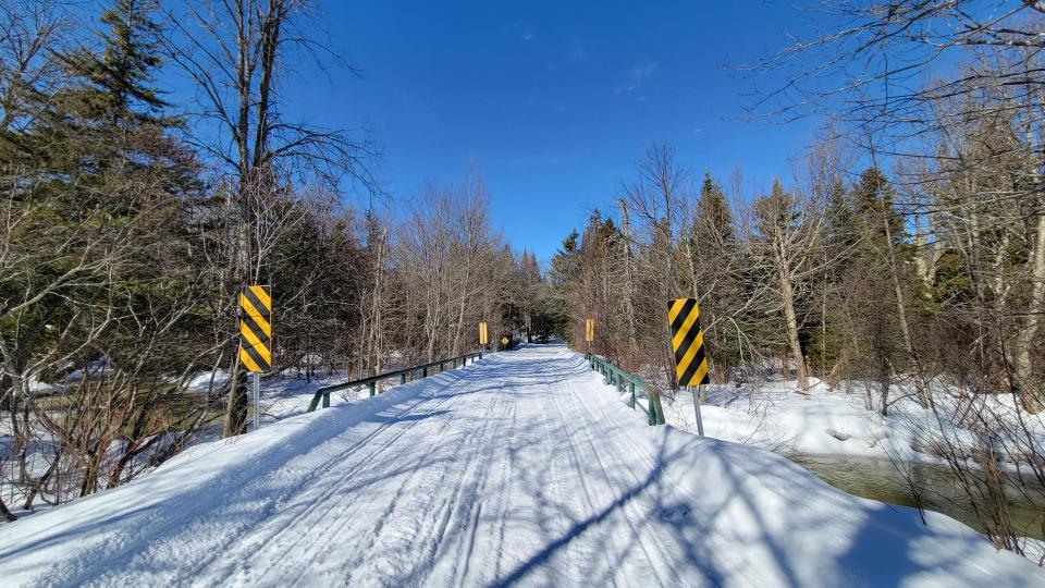
At mile 5, I got to Miami. Well, not the city, although it was feeling quite balmy out. I got to a small bridge crossing the Miami River, whose source is just north of Pillsbury Mountain, and flows into Lewey Lake. Both the lake and river make for great paddling destinations. The stream was flowing exceptionally strong given how warm the weather has been.
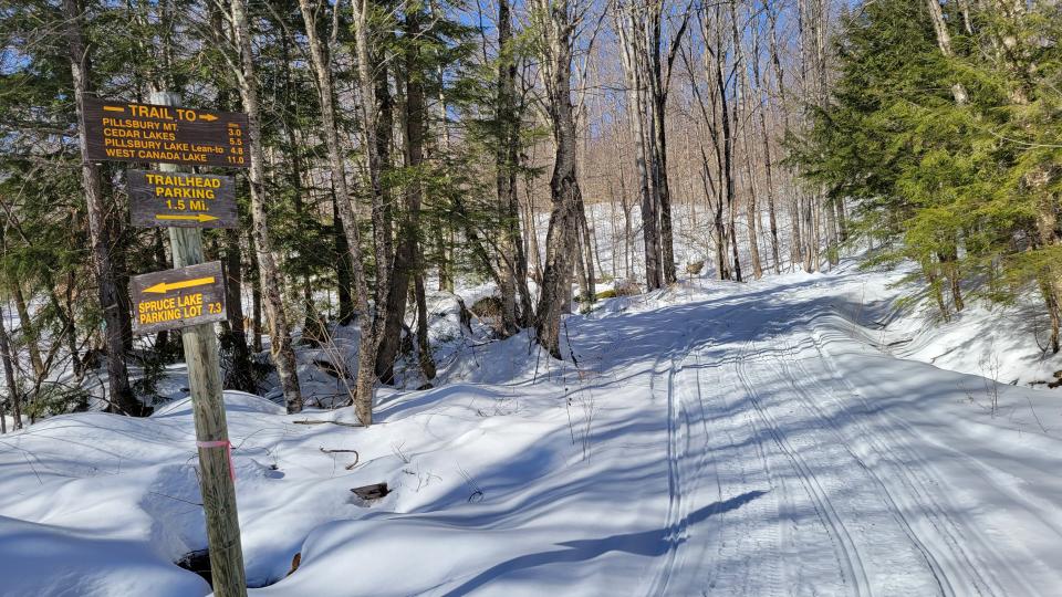
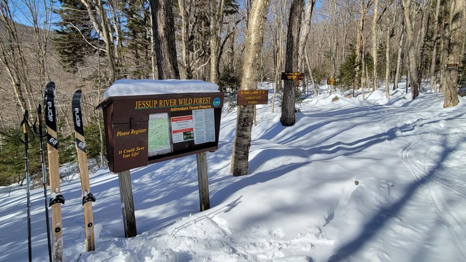
After some long stretches of gentle downhill skiing, I emerged into a wide-open area called Sled Harbor at 5.5 miles. It’s here that you park in the summer, and walk up to the old trailhead. I stopped for a few minutes to have a bite to eat, then continued a bit farther to the sign that signals the mileage for the old trailhead and other various destinations.
The trail starts to parallel the upper reaches of the Miami river at 6.2 miles. This was by far my favorite stretch of trail the entire day. The sunlight beamed through the hemlock-laden forest, the river ran loudly to my left, and the trail was wide enough so that I could gaze down at the river while not having to worry about running into any trees.
Time for snowshoeing
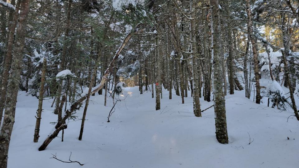
A little after 7 total miles, I finally reached the old parking area for Pillsbury Mountain, at 7 miles. It’s here that I would strap on my snowshoes, stash my skis a little past the signage, and make my way down to a newly-built wooden bridge that sits at the bottom of the short descent. This marks the beginning of the uphill fun.
Making the decision to come out all this way in the winter is not one taken lightly, and being prepared for the long day is part of recreating responsibly! With the solitude that you experience on this trail comes the acceptance that you’ll most likely be breaking trail for the 3 miles to the summit and back down to the old trailhead (all the more reason to bring friends along!). That’s exactly what this day had in store for me. It appeared that no one had been up in a very long time, which was confirmed by the logbook that had been replaced weeks prior, and had no sign-ins. The snow depth was as deep as my ski pole. While it surely takes work, this was all part of the adventure! The steep trail transitions from open deciduous forest to serene, snow-encrusted spruce trees about halfway up.
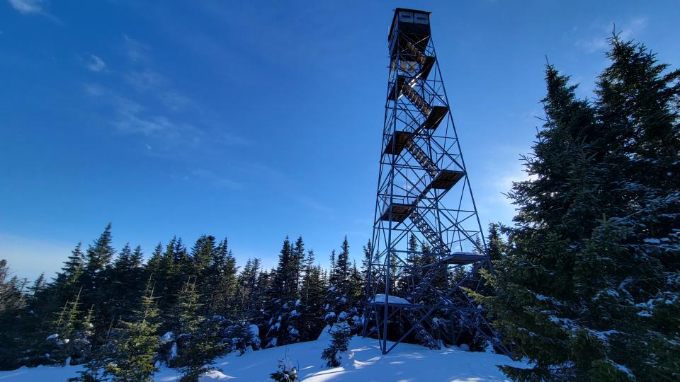
After a moderately steep ascent that took quite some time, I approached the 69-foot tall fire tower, situated at the end of a large clearing, and at the foot of the dilapidated observer’s cabin. I was mindful of how dangerous ascending fire towers can be in the winter, and opted to eat a large lunch midway up the tower. Above that, the cab isn’t open to the public, and the staircase isn’t guarded by chicken wire. From the tower staircase, I had extensive views of Indian Lake, and even other firetowers like Snowy Mountain!
The way back out
With daylight slowly fading away, I descended back to my skis, and started the long glide out to my car. It’s not for everyone, but recreating at night comes with so many perks. On this night, the skies were absent of clouds and filled with stars. When I skied adjacent to the wetlands that I encountered during my trip in, I was given an entirely different experience than before! Turning off my headlamp, I took in the moment, and gazed up at the night sky and the meandering Milky Way.
After a little over 16 total miles, I was back to my vehicle at Mason Lake. Legs tired, stomach growling, and heart full, my adventure had come to an end!
If you’re a beginner skier with experience doing long hikes, this is the perfect trip. It’s got engaging hills that aren’t unsafe, an interesting objective that is part of Hamilton County’s fire tower challenge, and one of the tallest peaks in the southern Adirondacks.
If you get done early enough, you’re in luck. Swing on over to Lemon Tree Brewery just a few minutes from Mason Lake; they have what you need after a winter epic. Enjoy food and a local craft beer, and start planning your next adventure!


